Relief for Meeker as Lee Fire pushes south

John F. Russell/Steamboat Pilot & Today
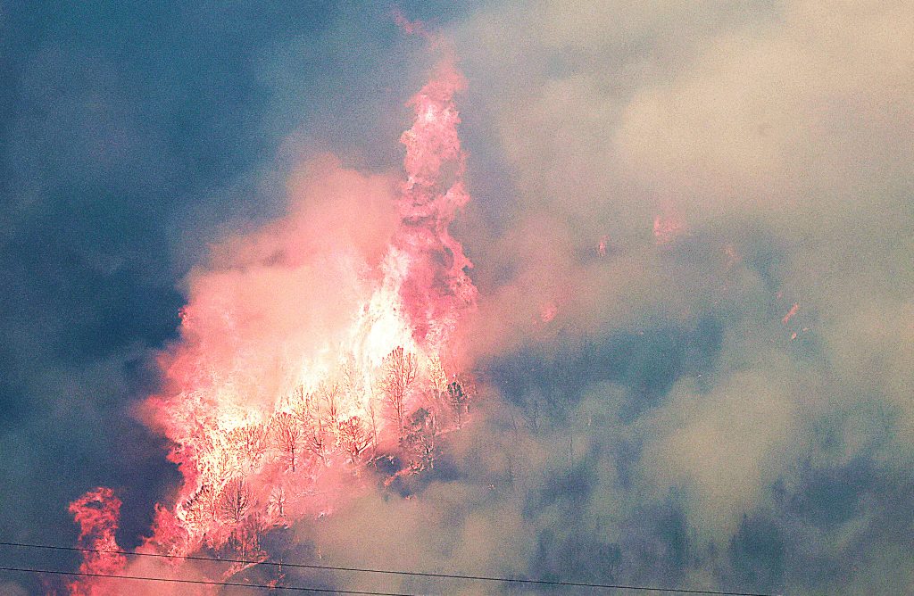
When the Lee Fire jumped Colorado Highway 13 in Rio Blanco County on Aug. 6, the town of Meeker was under threat.
Spreading north under red flag conditions, the flames threatened several homes east of the town. Pre-evacuation orders were issued and the community waited with bated breath to learn its fate.
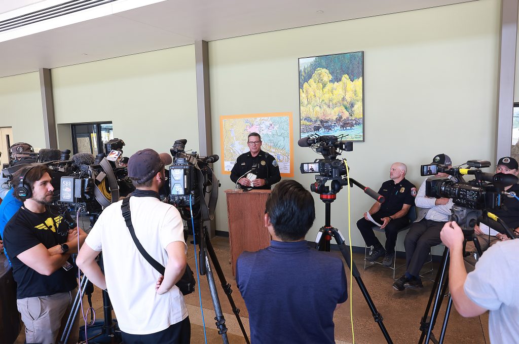
“Our strategy was to try to hold it at Highway 13 and we were doing this with a small group of people, nothing like we see here today,” said Rio Blanco County Sheriff Anthony Mazzola at a press briefing in Meeker on Tuesday.
Mazzola spoke at an organized press briefing earlier this week, joining officials representing Rio Blanco and Garfield counties, the U.S. Bureau of Land Management, the U.S. Forest Service and the Rocky Mountain Area Complex Incident Management Team 3, among others.
The sheriff described the sequence of events leading to the fire knocking on the door of the Northwest Colorado town. That sequence began with another fire, the Elk Fire, igniting on Aug. 2.
Mazzola explained how a witness reported a lightning strike, prompting volunteers with the Rio Blanco Fire Protection District and crews from the local BLM White River Field Office to respond.
Later that day, officials received word of two fires, the Lee and Grease fires, that started in the BLM-managed Piceance area southwest of Meeker.
“Those were small on that day, and we weren’t too concerned about it,” recounted Mazzola. “Our primary concern was the Elk Fire.”
With the Elk Fire growing and straining local resources, the sheriff, who is designated as the county’s official fire warden, requested assistance from a Type 3 Management Team with the state of Colorado.
The next day, “this fire starts blowing up and we have to do evacuations around the County Road 8 area,” said Mazzola. “Meanwhile, (the Lee and Grease fires) started to take off.”
On Aug. 4, the Lee and Grease fires joined and became one major fire labeled under the Lee Fire name.
“That really got everyone’s attention,” Mazzola said, and the Type 3 team called in to fight the Elk Fire relocated its focus toward the Lee Fire. But the shift in focus would not be enough, prompting the hiring of the Rocky Mountain Area Complex Incident Management Team 3 to be called in to take command.
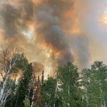
Two days later, extreme fire behavior caused by the combination of high winds, low humidity, high temperatures and freely available fuel brought evacuation orders to Meeker with the Lee Fire edging closer.
“Thankfully, a lot of people pre-evacuated on their own, just in case, and with the help from the teams that were here, the fire engines that were here, they were able to hold that up and it never did cross the town,” said Mazzola.
As of Friday morning, the Elk Fire was 93% contained at 14,518 acres with two residential structures and two outbuildings destroyed. A total of 215 people who had been under evacuation orders because of the initial fire have all been cleared to return to their properties.
“We are feeling really good about our progress on that Elk Fire,” said Tyler Nathe, operations section chief with the Rocky Mountain Area Complex Incident Management Team 3.
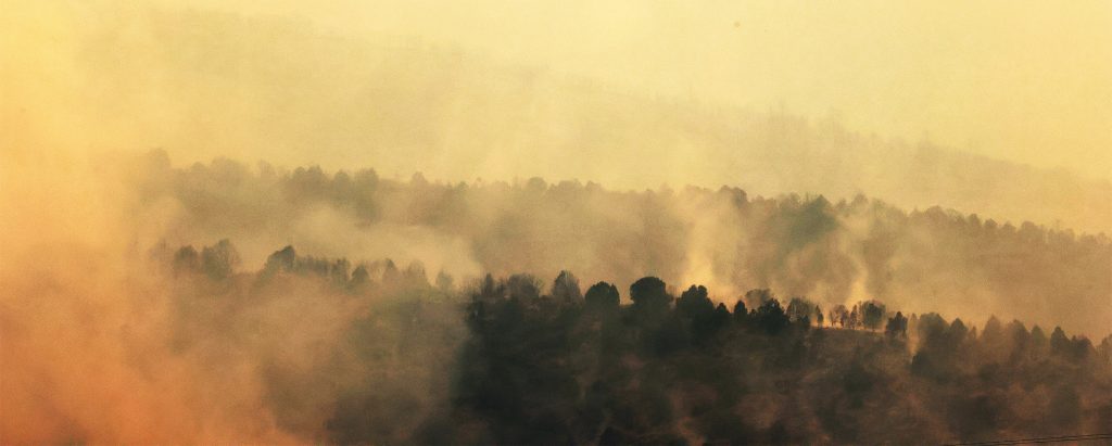
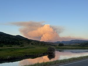
“(The Lee Fire) is the one that has drawn all the attention right now,” he added. “It is the big smoke plume everyone is seeing from halfway across the state here.”
Nathe noted earlier this week that the flames from the Lee Fire around Meeker were “pretty well-locked in and secured.”
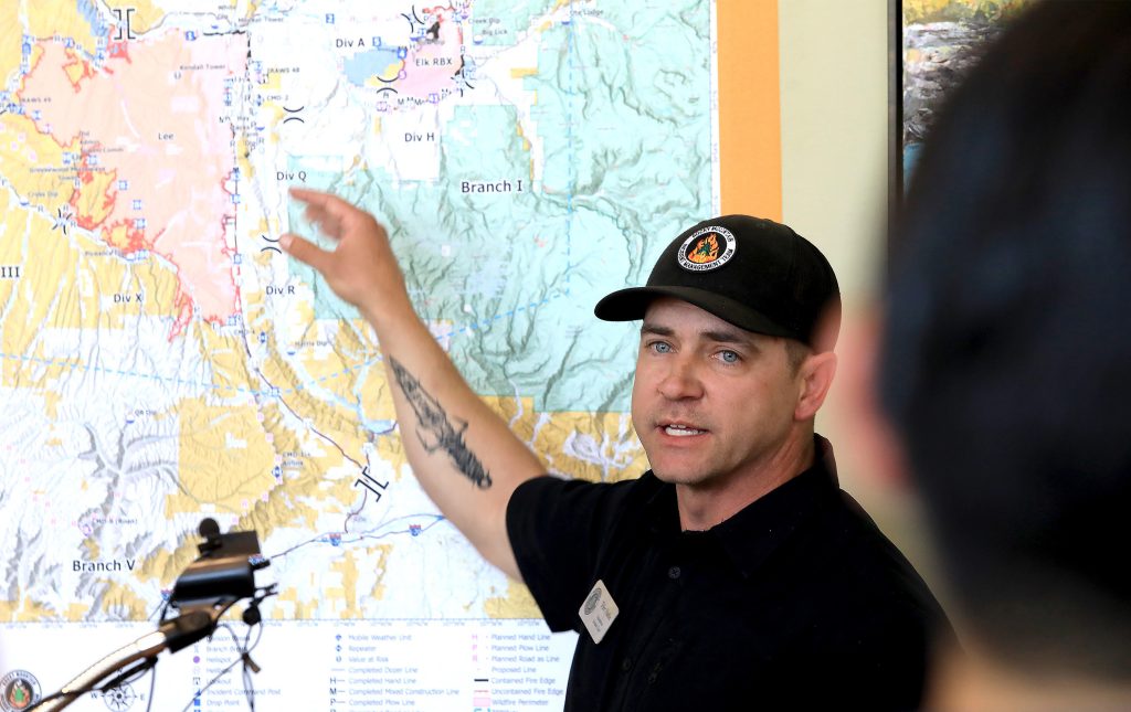
“That was a priority for us, that is how we deploy our resources — we identify priorities, values at risk in the area that we want to focus our efforts on protecting, and moving out from there,” he said. “We are feeling really good about the threat to the town of Meeker no longer being there. Of course, we still have resources in place that are going to be in and throughout the area as we go through the duration of this incident.”
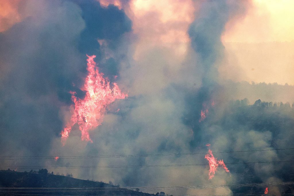
With the Elk Fire largely controlled, all attention remains on the Lee Fire, which was reported as 12% contained across 133,841 acres on Friday morning — making it the fifth largest wildfire in state history.
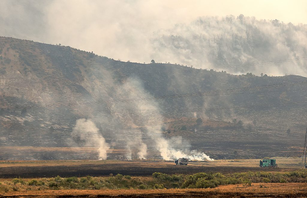
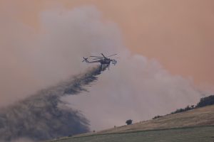
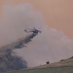
A total of 1,274 firefighters were on the ground working the multi-county fire as of Friday afternoon, accompanied by a fleet of helicopters, fixed-wing aircraft and drones flying overhead.
So far, more than 800 people have been issued evacuation orders in Rio Blanco and Garfield Counties as a result of the Lee Fire. Three residential buildings and 12 outbuildings have been reported as destroyed as a result of the fire, according to the Rio Blanco Sheriff’s Office.
Going ‘indirect’
In the days following Aug. 6, when the Lee Fire jumped Colorado Highway 13, Nathe said crews took an “indirect strategy” to keep the fire from jumping the road as it moved south toward Garfield County.
“Extreme fire behavior changes how we address those things,” said Nathe. “Often times, we like to get in on that fire’s edge and take it on as direct as we can — that is often one of the safest and most effective ways for us to battle fires like this, and with the conditions we are having and with how fast it is moving, we have had to switch to a more indirect strategy.”
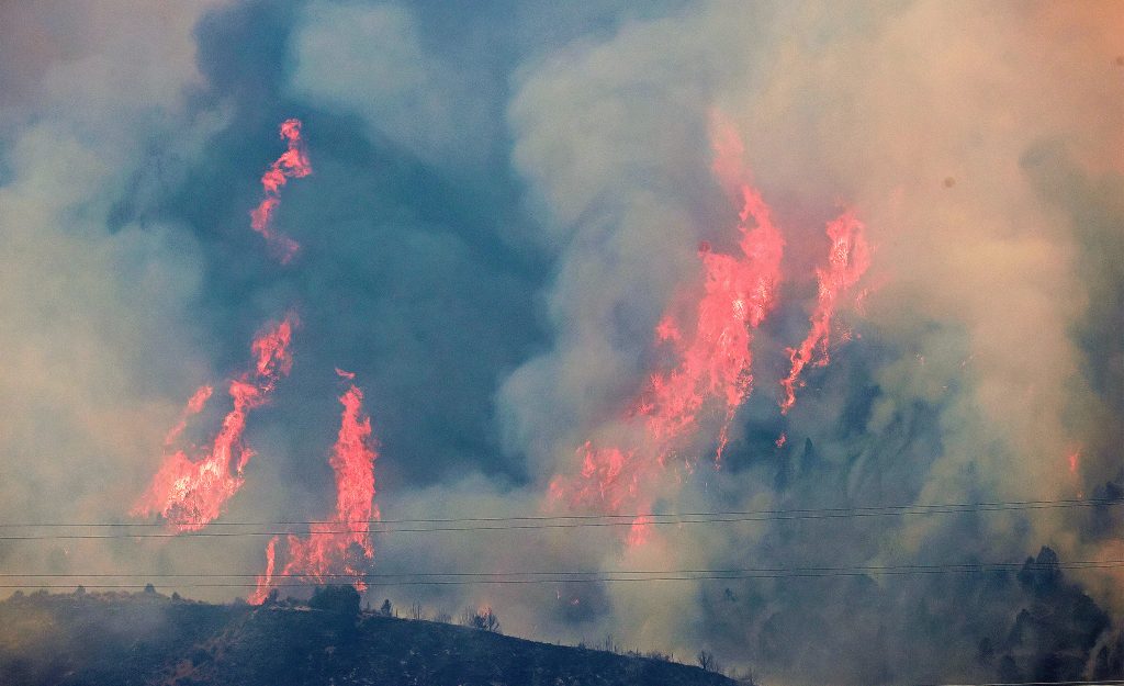
Last Friday afternoon, Aug. 8, the Lee Fire advanced 30,000 acres to the south as crews worked to light backfires on the west side of Highway 13 and strategically cut fire lines in an effort to slow the fire’s spread.
“Picking lines that are a bit farther out and anchoring them into a road system or a natural feature — a canyon wall or something like that — and then utilizing timing with the weather and the wind to line up and do strategic firing,” added Nathe. “What that allows us to do is to create fire and bring it to a containment feature on our terms and under our control instead of allowing the fire to dictate that for us.”
Into the fire zone
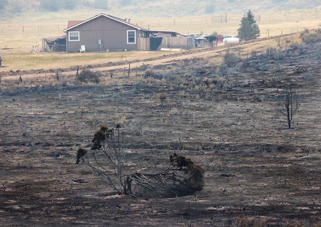
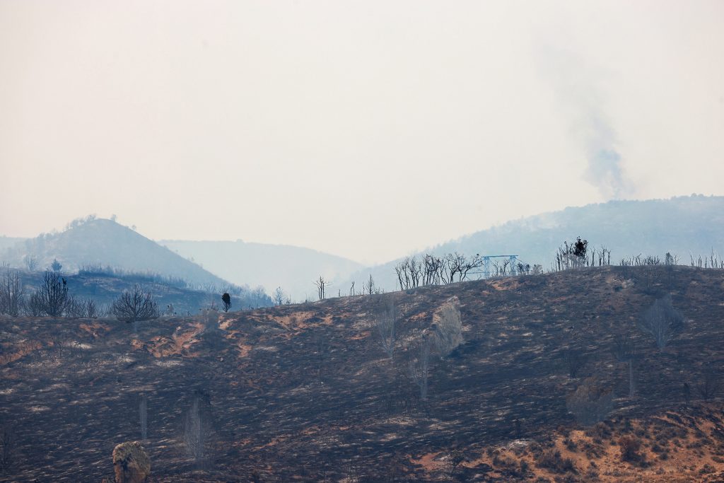
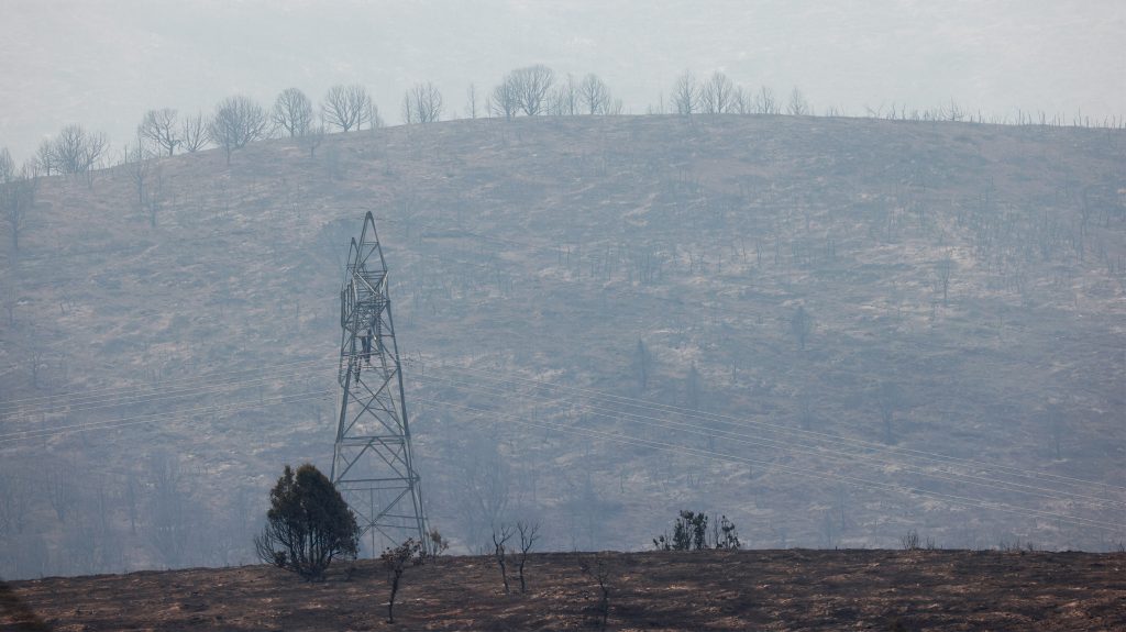
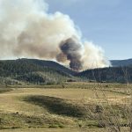
Heading south on Highway 13 as part of an escorted media tour of the active fire area, the destruction from the Lee Fire, and the effort from the fire crews working to contain it, were clear.
Passing through a police checkpoint, the scorched earth on both sides of the road stretches as far as the eye can see.
But after roughly five minutes, the scene changes: on the west side of the road, the burned earth and brush continue against the stark contrast of saved barns and homes lining the state highway.
Even more stark is the view of the eastern side of Highway 13, where the efforts from the fire crews lighting backfires ultimately preserved the vibrant and lush greenery one is accustomed to seeing in Northwest Colorado in August.
“The indirect strategy and that approach has been very successful for us, and so it is a combination of that strategy and where the conditions allow to give us the opportunity to get in close and hit that direct, we are taking advantage of those opportunities with the resources we have,” said Nathe.
Still, the success remains precarious. Hot spots burning in the distance to the west sent plumes of smoke into the air. Just shy of the halfway point between Meeker and Rifle, the media convoy pulled to the side of the road as a hillside to the west side of the highway erupted in flames, licking more than 100 feet in the air.
After the broadcast journalists performed their stand-ups, the press tour would go no further. The caravan of vehicles turned around and drove north through the smoke and into the relatively clear blue skies above Meeker.
Relief for Meeker — Reinforcement for Rifle
Rio Blanco Sheriff Mazzola applauded the efforts of the fire crews who worked to defend the town of Meeker against the Lee Fire.
“It has been amazing to watch the support from the town coming together, working together with our federal partners to fight these fires, our state fire guys coming in and helping us,” said Mazzola
“It has been an amazing journey, it has been wild and scary but, you know, we are a rural county and we bond together and we work together and I just want to say thank you for all the support out there that we are getting outside of this community because it is much appreciated,” he added.
But with officials having essentially cleared any fire threat to Meeker, all eyes are now turned to Garfield County and, specifically, the city of Rifle, which lies just south of the fire’s leading southern edge as of Friday.
Still, despite the looming threat, officials have expressed confidence in their strategy and preparation should the fire encroach on the city.
“We don’t anticipate the Rifle community impacted and we are feeling really comfortable with what we have here, but we are planning as a team so that in the unlikely event that we do get something that progresses further south, we are ready for it, we have plans, we have the resources and we have the capabilities to address that if it becomes an issue,” Nathe said Tuesday.
Trevor Ballantyne is the editor for the Steamboat Pilot & Today. To reach him, call 970-871-4254 or email him at tballantyne@SteamboatPilot.com.


Support Local Journalism
Support Local Journalism
Readers around Steamboat and Routt County make the Steamboat Pilot & Today’s work possible. Your financial contribution supports our efforts to deliver quality, locally relevant journalism.
Now more than ever, your support is critical to help us keep our community informed about the evolving coronavirus pandemic and the impact it is having locally. Every contribution, however large or small, will make a difference.
Each donation will be used exclusively for the development and creation of increased news coverage.