Yampa River is wild, especially from the air
-
An aerial view of the confluence of the Yampa and Green rivers at Steamboat Rock with an assist from LightHawk Conservation Flying and pilot Jack Dysart.
Tom Ross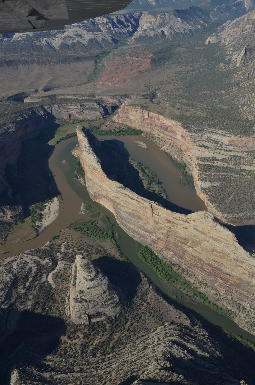
-
The Yampa River pours into the nonstop fury of Split Mountain Canyon with Deer Lodge Park visible beyond the canyon from the vantage of a single-engine airplane flight a single-engine airplane flight funded by LightHawk Conservation Flying and flown by Steamboat Springs Pilot Jack Dysart.
Tom Ross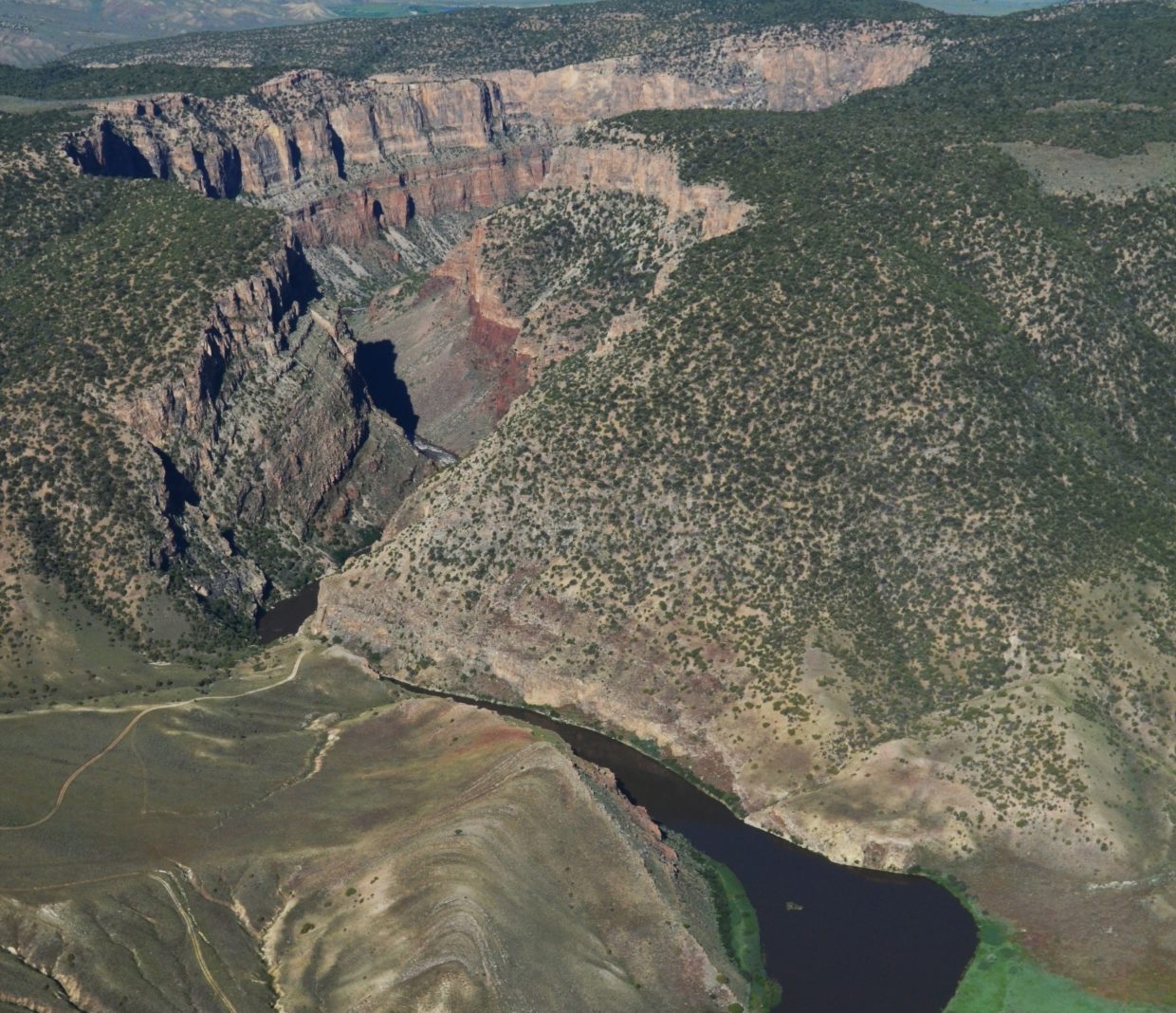
-
A roaring plume of whitewater flows through bypass valves at Flaming Gorge Dam in Utah as its managers follow through with plans to ramp flows up to 8,600 cubic feet per second on June 5. The Green's near record flows will blend with the slightly below average flows of the Yampa River in Dinosaur National Monument.
Tom Ross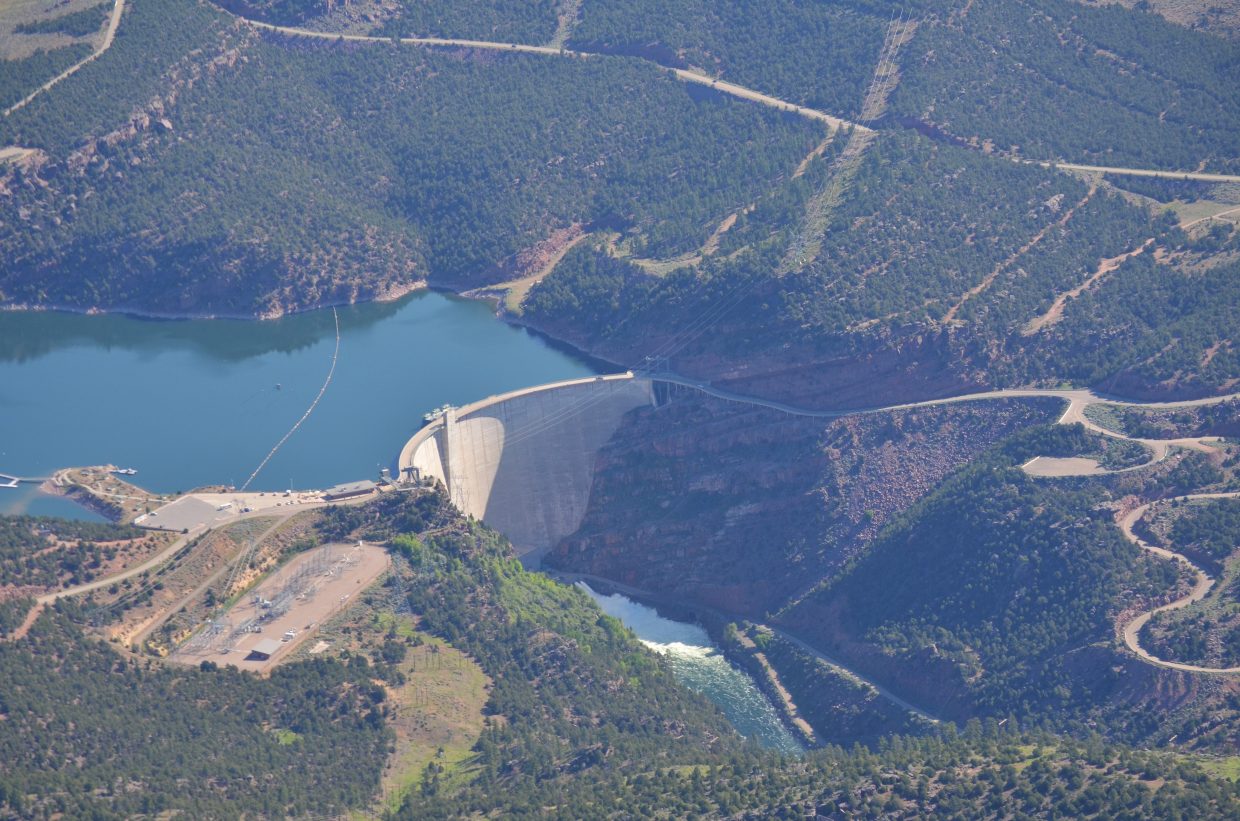
-
-
A team of rafters takes an unconventional approach to hedging its odds for surviving Charlie's Hole on the Yampa River.
Tom Ross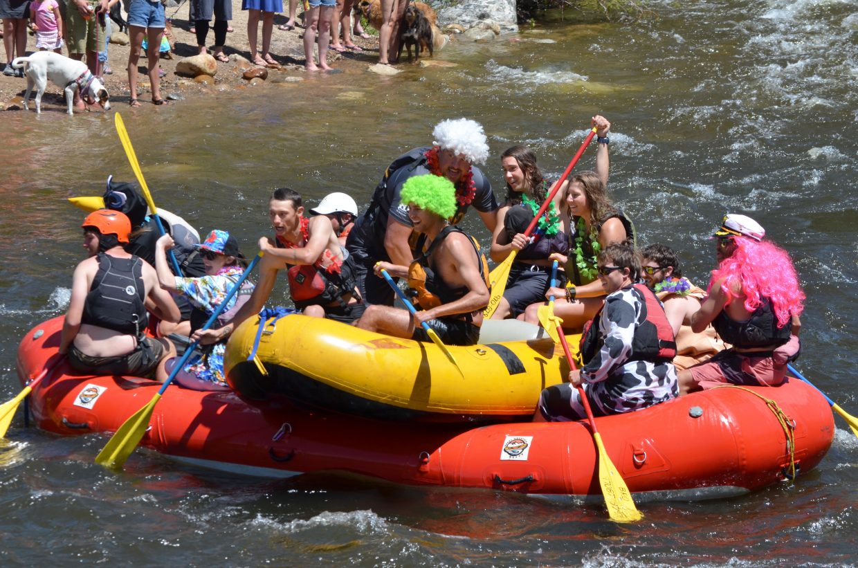
-
Meanders on the Yampa River just above Stagecoach Reservoir. Aerial view courtesy pilot Jack Dysart and LightHawk Conservation Flying..
Tom Ross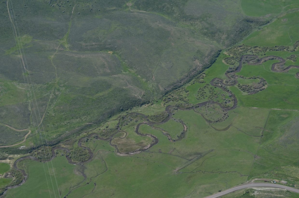
-
Charlies Hole spits out another pair of skilled paddlers during the 2017 Yampa River Fest.
Tom Ross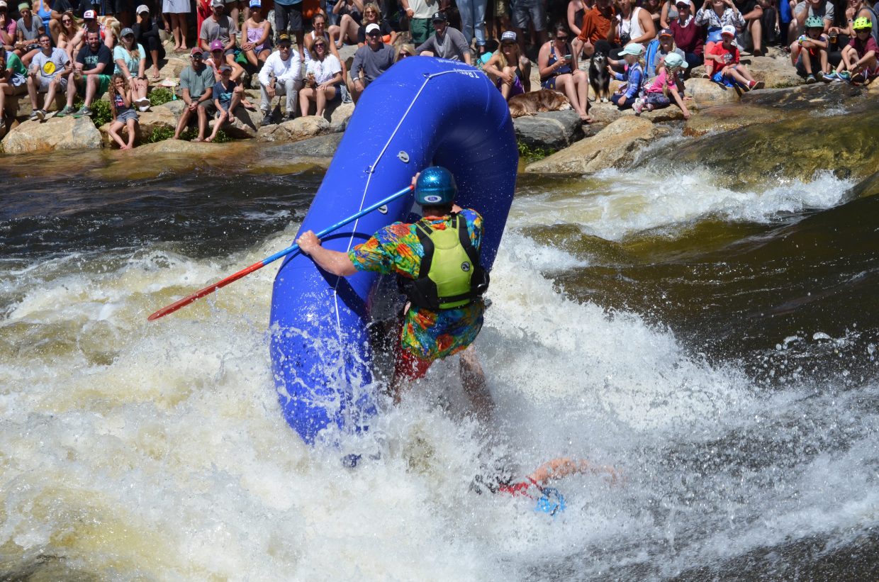
-
A pair of rafters can't overcome the standing wave in Charlie's Hole during the 2017 Yampa River Fest.
Tom Ross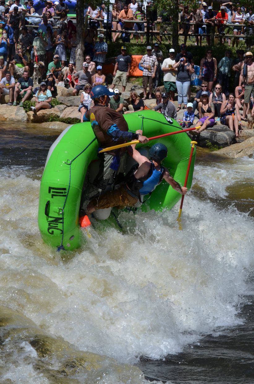
-
The many times the Yampa River folds back on itself in LIttle Yampa Canyon are easily appreciated from a single-engine airplane flight funded by LightHawk Conservation Flying and flown by Steamboat Springs Pilot Jack Dysart.
Tom Ross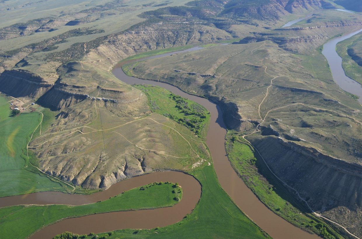
“The Yampa is the wildest river in the upper Colorado River Basin and that matters!” Friends of the Yampa’s Kent Vertrees proclaimed before a packed house at the Chief Theater June 1.
The audience had gathered to hear from some of the foremost water experts in the region, along with representatives of the nonprofit Friends of the Yampa on the eve of Steamboat Springs’ annual Yampa River Fest.
Two days later, audience members witnessed just how “wild” the Yampa River can be right in downtown Steamboat, as daring rafters challenged the handmade rapid known as Charlie’s Hole. In early June, as the river reaches its peak runoff, Charlie’s Hole generates a standing wave originally designed to be surfed by expert kayakers.
Things get really wild during river fest, as teams of rafters, using only paddles instead of powerful oars, sneak up on Charlie’s Hole in its powerful eddies and, with several quick thrusts of their paddles, charge sideways. Many are spit out like a rotten cherry tomato, others find a groove in the wave and survive for 15 to 20 seconds before their watercraft are launched into the air, and the paddlers take a swim in the frigid water.
One band of rafters entered the rapid with one raft stacked on top of a larger raft and passengers in both. The resulting carnage was predictable.
Of course, the concept of a wild river has different connotations. Vertrees’ proclamation at the Chief that the Yampa is wild was based on the river’s status as the last major river in the upper Colorado Basin whose flows have not been detrimentally interrupted by storage dams.
In the parlance of conservationists, the Yampa is “wild” because it is widely regarded as having the fewest dams impeding its flows of any major river in the American Southwest. The profound implication is that the many species of animals and plants that have evolved over the millennia around the river’s annual rise and fall continue to thrive in the Yampa.
University professor, author and former whitewater outfitter Patrick Tierney has written that in spite of a handful of small dams on the Yampa’s headwaters and also on several tributaries, the river maintains the characteristics of a wild river over the course of almost 250 miles.
“These enduring characteristics make the Yampa a benchmark by which other rivers can be compared and well illustrates the threats facing rivers throughout the West in a period of climate change and rapid population growth,” Tierney wrote in the 2015 book, “Colorado’s Yampa River,” which he collaborated on with the noted nature photographer John Fielder.
Yampa is a high-yield drainage
Eric Kuhn, who will step down as manager of the Colorado River District next year after 36 years, told his audience at the Chief this month the perception that water from rivers on Colorado’s Western Slope is being diverted across the Continental Divide to support a booming population on the Front Range is somewhat misleading.
“The reason we have trans-mountain diversions isn’t for people, it’s for their lawns,” Kuhn said. “The Yampa can support a hell of a lot of people.”
[swift-jw-player id=”9Lv9JEgl”]The Colorado River drains seven states and produces 15 to 16 million acre feet of water, and the Yampa, which averages 1.62 million AF annually, represents about 10 percent of the total, Kuhn said.
The Yampa and the Green are typically on close footing, with the Yampa contributing about 45 percent of its combined flow below the confluence, and the Green, about 55 percent. But it’s a different story this year, and one that demonstrates how drastically snowfall can vary from mountain range to mountain range.
While the Yampa Basin saw subpar snowpack in the winter of 2016-2017, the upper Green, including the Teton and Wind River ranges, experienced 230 percent of average snowpack.
“It really hit Jackson Hole, the Wind Rivers and northern slopes of the Uintah Mountains (in Utah),” Kuhn said. “It shows that just a matter of 100 to 200 miles can make the difference between moderately dry (conditions) and potential record runoff.”
The snowmelt that pours off the Gore and Park ranges every spring in creeks called Morrison, Sarvis, Green, Harrison, Priest and Walton upstream from Steamboat, transforms what is basically a mountain stream along its first 25 miles into a significant river. But it’s the Elk River, which flows into the Yampa 8 miles west of Steamboat, that doubles the flow of the river with another load of Park Range snowpack.
“The Yampa is made by the Park Range,” Upper Yampa Water Conservancy Manager Kevin McBride said. “That’s where the deep stuff is — Walton Creek is the highest yielding basin per acre in the entire state of Colorado. The Yampa is wild!”
[swift-jw-player id=”OYBguQ3W”]To reach Tom Ross, call 970-871-4205, email tross@SteamboatToday.com or follow him on Twitter @ThomasSRoss1


Support Local Journalism
Support Local Journalism
Readers around Steamboat and Routt County make the Steamboat Pilot & Today’s work possible. Your financial contribution supports our efforts to deliver quality, locally relevant journalism.
Now more than ever, your support is critical to help us keep our community informed about the evolving coronavirus pandemic and the impact it is having locally. Every contribution, however large or small, will make a difference.
Each donation will be used exclusively for the development and creation of increased news coverage.