Environmental impacts, patrol challenges, sidecountry danger all in consideration as Steamboat Resort expands
Maps show where gladed runs in new Pioneer Ridge terrain could be

Suzie Romig Follow

John F. Russell/Steamboat Pilot & Today
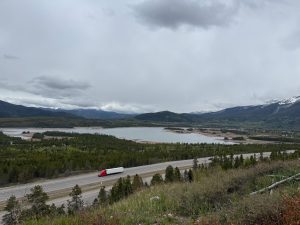
With fresh snow and recent bluebird days, the new lift line on the far north side of Steamboat Resort is extremely visible and less than a year away from in-bounds use. The ski area is planning to expand its operational boundaries with the Pioneer Ridge lift servicing 650-plus acres of advanced or expert terrain in the 2023-24 season.
Officials with the Routt National Forest and Steamboat Resort worked together to approve that line and will continue to do so as the lift is installed and the terrain around it opens. It’s not an unfamiliar partnership, as the ski area is a major permittee on U.S. Forest Service lands.
Since the beginning of the $200 million Full Steam Ahead capital improvement project at the resort, officials from the two entities have met weekly, working even more closely “to be successful for both the forest and the resort,” said Michael Woodbridge, district ranger for the Hahns Peak/Bears Ears Ranger District.
During land manager updates at the Routt Recreation and Conservations Roundtable meeting on Feb. 9, Woodbridge provided a brief update on the ski area’s expansion, including a request from the resort to move the base of the forthcoming Pioneer Ridge lift closer to Burgess Creek.
The shift of the Pioneer Ridge lift was not in the original 2018 environmental impact statement, but in December, the resort and the Forest Service came to an agreement to alter the lift terminal disturbance areas for the addition of the new chairlift this summer, Woodbridge said.
After consultants completed on-the-ground engineering and design reviews, resort officials requested to shift the bottom lift terminal closer to Burgess Creek for smoother entrances and exits. So, the supplemental information report added watershed health mitigation measures including a retaining wall and a sediment capture pond at the bottom terminal.
“That’s getting close to the creek, and the resource specialists have concerns about getting into that area,” Woodbridge explained, noting that Burgess Creek provides habitat for a native cutthroat trout restoration project.

U.S. Forest Service-SE Group/Courtesy photo
Approximately 1.5 acres of grading is planned to complete the terminals, which is a smaller amount than originally approved in 2018, and a bridge over Burgess Creek has been moved to a slightly different location, according to the supplemental information report.
The previously approved alignment for the Pioneer Ridge lift will remain the same, with the cut through the trees now visible from around Steamboat Springs. As described in 2018 Environmental Impact Statement, the proposed lift is to be 6,450-feet long with a capacity to move 1,800 passengers per hour.
The Forest Service completed two environmental studies in 2018 and 2021, which include some guidance for opening 650 acres of additional in-bounds terrain for the 355-acre Pioneer Ridge and 295-acre Fish Creek Canyon areas. The expansion area currently lies within the resort’s special-use permit permanent boundary but will become part of the resort’s operational boundary for the 2023-24 ski season.
What matters in your community, delivered daily.
Sign up at SteamboatPilot.com/newsletters
The changes to the Pioneer Ridge lift illustrate the ongoing planning and management issues that arise as the resort’s projects progress, Woodbridge said.
“We are planning things well so that we can avoid impacts to the public or the Forest Service land,” Woodbridge said.
The letter, ideally completed by May, will “make sure the resort is clear on what the guidelines are that they are following,” Woodbridge said.
The weekly meetings cover topics ranging from drainage management plans, to the best places to stage towers before installation, to changes in snow-making systems.
The district ranger said the Forest Service currently is creating a “project review letter” that summarizes key points from the extensive, 449-page environmental impact statement from 2018 and an 84-page environmental assessment from 2021 that are both available at FS.USDA.gov/project/?project=58336.
The ski area has a deadline to submit the resort’s summer operating plan to the Forest Service by April 30, Woodbridge said.
The terrain underneath the forthcoming Pioneer Ridge lift is similar to terrain in the Pony Express area, according to local expert skiers. Adjacent to the Pioneer Ridge expansion is the “sidecountry” area of Fish Creek Canyon, which has been controversial to open for in-bounds access.

U.S. Forest Service-SE Group/Courtesy photo
At the State of the Snowpack event in January — hosted as an educational evening and fundraiser for the Friends of the Colorado Avalanche Information Center — some voices in the crowd of backcountry enthusiasts shouted, “keep it closed,” when emcee Kent Vertrees mentioned the upcoming opening of the Fish Creek area for in-bounds skiing.
“It’s been holy ground for locals for so many years,” Vertrees, “master of chaos” at Steamboat Powdercats, explained this week. “To open that terrain, it can be hard on people. That is a refuge for people who do seek powder and a sidecountry or backcountry feel with lift access.”
Advanced skiers can access the currently out-of-bounds 650 acres from resort gates, such as the one near the top of the Pony Express lift. Then, those skiers usually join the in-bounds runs where the Outlaw run curves to the northeast or farther down to a northeast point of BC Ski Way, though a climb is required.
Trends at other ski areas are to open more sidecountry or backcountry areas off the edge of resorts such as in Aspen, Telluride and Jackson Hole, Vertrees said.
“Seems like that’s the direction we are going here. It’s a tough topic,” he said. “Trends in the ski area world is they keep expanding, but how much is enough?”
Vertrees said management of the Fish Creek acreage will be “daunting due to the cliff bands, terrain hazards and increased use.” Although Vertrees is an expert skier who has skied in Steamboat since 1994, he does not ski the Fish Creek area without someone else who knows the area very well.
“The challenges are how to manage the hazards because it is legitimate expert terrain, larger cliff bands, more remote,” he said. “It means (the resort) is going to have to mitigate avalanches more. It’s going to be a learning curve for the ski area, Ski Patrol and any newcomers who go in there because there are real hazards.”
According to the resort, “Pioneer Ridge (provides) 650 additional of expert/advanced acreage that will make Steamboat the second largest ski resort in Colorado, from the fifth largest currently. Steamboat has long been known for our pristine intermediate terrain, and this new expansion will put us on the map for the best skiers and snowboarders in the world.”
Steamboat Resort Communications Manager Maren Franciosi said the resort will provide more details about the Pioneer Ridge and Fish Creek terrain management plans as specifics become available.

John F. Russell/Steamboat Pilot & Today
“As far as the management plan from a patrol standpoint, that is still in the works, and we will reach out when we have more information to share, likely this summer,” Franciosi said via email. “We are looking forward to giving more info to the public on this exciting expansion.”
Franciosi said more information about the resort’s plans is available by reviewing the Steamboat Resort 2019 Master Development Plan Amendments completed in July 2019, which is available at SkiMap.org/data/500/3100/1593461046.pdf.
Of interest in the master plan might be statistics that support the resort’s desire to expand terrain options. Almost 1.1 million guests visited the resort during the 2018-19 season, and the resort at the time had a “comfortable carrying capacity” of 13,050 daily guests. Proposed upgrades listed in the 2019 master plan would increase the comfortable carrying capacity to 16,310 daily guests.
“Steamboat has consistently drawn the level of crowds that warrant the need for upgrades to improve the guest experience,” according to the master plan.
Jay Bowman, who has been with Routt County Search and Rescue for 12 years, said the team is called in to help with rescues in the Fish Creek Canyon area about three times a year for people injured or lost after exiting the backcountry gates from the resort.
“We are certainly concerned about it, and we have been talking about it with Ski Patrol,” Bowman said. “We remain concerned, but it depends on where they set the new boundaries and what terrain actually gets opened.”
Bowman also said an undetermined number of skiers miss their turn back to the ski area runs and end up coming out on their own to Fish Creek Falls trailhead area every winter. Many times, these people end up calling a friend for a ride.
Aside from steep cliffs and tight trees, Bowman said his major concern is the lack of mechanized or snowmobile access to the Fish Creek area during a search. The team must access the area via backcountry skis and pull a toboggan in order to assist Ski Patrol.
“The terrain is just too difficult and too tight,” Bowman explained.
The 2018 environmental impact study noted that use estimates of the Fish Creek acreage vary widely from 50 to 500 users daily, especially on powder days.
Bowman and Vertrees mentioned tactics or tools that other ski areas have used to manage access to extreme terrain areas ranging from guides to gates that open for users with an avalanche transmitter. Both say more education, awareness and signage will be necessary as more skiers and riders are anticipated to enter the area next ski season.
“Know before you go,” Bowman advised. “I would not recommend adventuring into that territory alone or without somebody who is knowledgeable about the terrain.”


Support Local Journalism
Support Local Journalism
Readers around Steamboat and Routt County make the Steamboat Pilot & Today’s work possible. Your financial contribution supports our efforts to deliver quality, locally relevant journalism.
Now more than ever, your support is critical to help us keep our community informed about the evolving coronavirus pandemic and the impact it is having locally. Every contribution, however large or small, will make a difference.
Each donation will be used exclusively for the development and creation of increased news coverage.